
Laden...
Laden...
We automate engineering and specialist work on image data: on drone imagery, construction-site photos, point clouds and in goods receiving. Built in Cologne, scientifically grounded, delivered in a project together with you.
We don't build universal tools. We develop specialised computer vision models that work in your data environment: little training data, rare events, heterogeneous sources. Every project yields reusable software modules, and modules become products.
Drone and satellite imagery, ground-based cameras with or without RTK, laser scans. Plus existing data such as CAD models and PDF documentation. We work with whatever your process provides.
We detect, classify, measure and locate objects in orthomosaics, point clouds and photos. We reconcile real-world situations with plans and models — with a confidence value per object and a review step by your expert users.
Human-in-the-LoopWe deliver results in structured form to where you work: as GeoJSON into your GIS, into BIM workflows or to your inventory management system. Not an isolated solution, but a building block in your process.
Three solutions at production or advanced maturity, each backed by a concrete project.
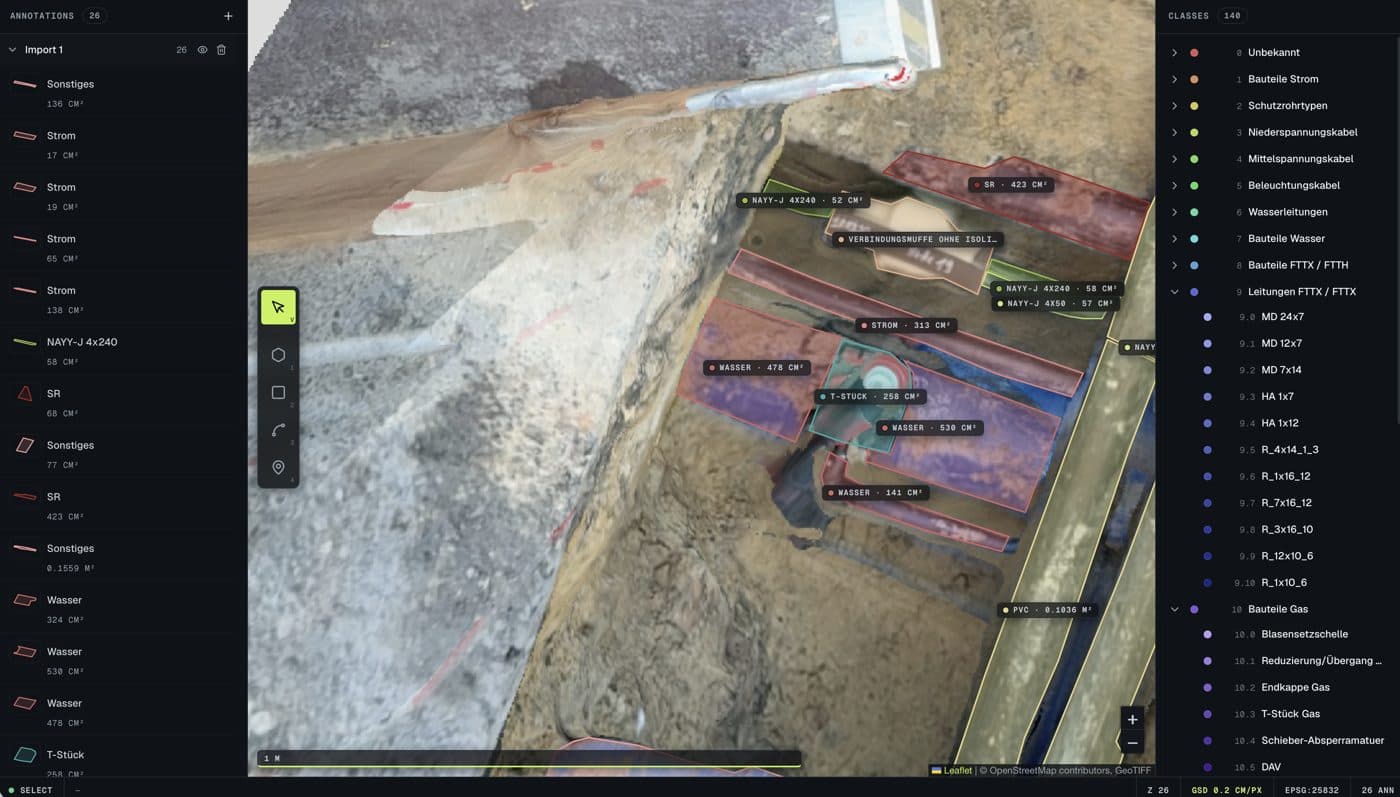
Photographically capture open trenches, detect and measure utility lines and components, document them GIS-ready — with Luure Surveying AI. Less rework at the desk, documentation straight from the site capture.
Automated evaluation of drone imagery: segment areas, detect objects, document damage. For drone service providers who want to deliver their clients more than raw data.
Part identification through automated comparison between a CAD model and a photo of the real component: in goods receiving, in spot-check inventory, during stocktaking.
Atrios is digitalising utility construction. The Luure Surveying AI detects, classifies and measures components, utility lines and other elements from georeferenced site imagery and returns them in structured form to the geoinformation system.
View reference →




Structuring the use case, technical feasibility assessment, project plan.
Your process, your pain points, first sample data.
Data preparation, annotation, building the training base.
Raw data from your operations, expertise to assess the cases.
Model development, training, integration into your systems.
Feedback from practice, access to test data and environments.
Measurement against pre-defined criteria, an honest result, expansion stages.
Assessment in everyday work, decision on the next step.
The typical entry point is a paid feasibility study with a clear outcome: it works, or we tell you why not.