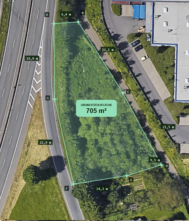
Our AI-assisted surveying solution significantly accelerates and improves the precision of planning, inspection and documentation in the skilled trades and construction sector. In georeferenced imagery, our AI automatically identifies key fixed-point elements and derives relevant distances and volumes. We target an accuracy of under 20 cm and are working towards results compliant with DIN 18710.
What we deliver:
- GDPR-compliant storage and processing of image data
- Fully automated stitching of footage into an orthomosaic
- Segmentation of surfaces and structural building components
- Generation of 3D building surveys
- Detection of critical fixed-point elements (e.g. building edges, connection points)
- AI-assisted measurement of relevant distances and volumes
- Exportable data for GIS systems and planning software